Plant trees remotely with smartphones using drones and LIDAR (Light Detection
and Ranging)
Project Context
Our climate is changing as we speak and we humans are responsible for it! The glaciers are melting, sea levels are rising, summers are getting hotter and winters colder, wildlife habitats are turning to human habitats, hurricanes are becoming a common phenomenon, and the list goes on.
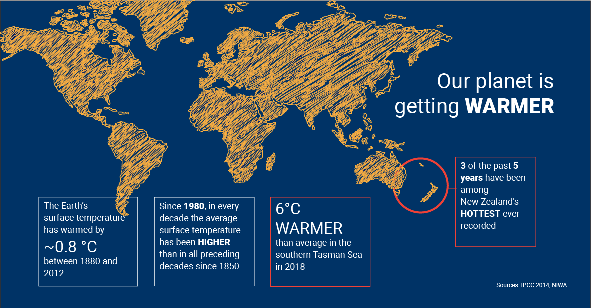
Sea levels in New Zealand have been steadily rising since the beginning of the last century. Over the past 40 years, one-third of the ice volume in the NZ Southern Alps has disappeared. As per the IPCC climate projections, there’s ~5% increase in extreme rainfall, 10%+ chances for intense thunderstorms in New Zealand.
Our planet is getting warmer
Role
Client: Academic project Role: Research, concept, visualisation, and testing Tools: Axure, Photoshop, Illustrator Skills: Primary and secondary research, UX & UI design, Prototyping, User testing Duration: 3 weeks
Mitigation: Reducing emissions of and stabilizing the levels of heat-trapping greenhouse gases in the atmosphere
Adaptation: Adapting to life in the changing climate by adjusting to actual or expected future climate
Adaptation is more of a resultant necessity. Our focus should be on how we can mitigate and reverse this change.
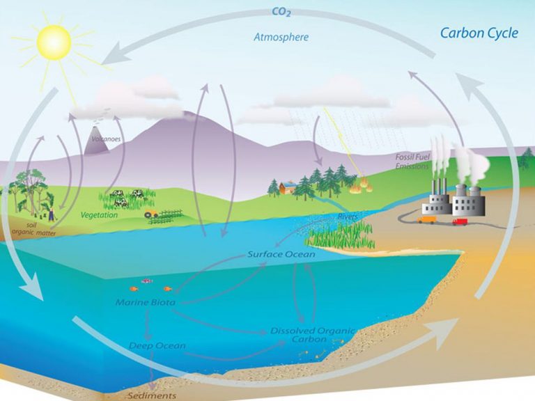
The solution is to reduce the emission of greenhouse gases by burning fewer fossil fuels and enhancing “sinks” such as oceans, forests and soil that accumulates and stores these gases.
To counter deforestation, a paradigm shift in the way we treat our trees is required.
To most of us, if asked, whom they care the most, they would call out their immediate family members, friends or pets. We need to broaden this circle of care to include trees as well. And, to build such a culture, we need to reinvent and re-imagine the way we plant, grow and care for trees. We have to come up with an innovative solution that uses a human-centered and technology-enabled approach to make it happen.
The Big Idea
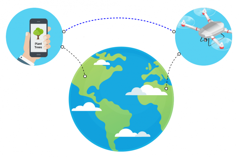
Imagine a scenario where you can plant a tree from anywhere in the world with just a tap on your smartphone. You can remotely monitor its growth, health and watch live streaming as well as 3D simulated views.
Plant a tree from anywhere in the world
The idea is to build a mobile app that allows a user to select a region and location for planting, choose tree types, input the number of seeds to be planted and just tap on your smartphone to see your seeds get planted using automated-drones.
This concept has the potential to revolutionize planting trees, stimulate the growth of native wildlife, promote tourism, and help build the intended emotional bond between humans and trees. The reason a smartphone medium is used for this concept because they have already evolved into the “circle-of-care” for most humans.
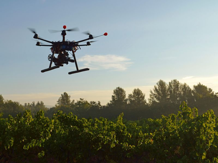
Seed planting drones
Technological Possibilities
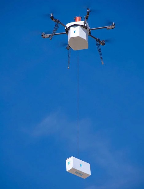
Drones are already being used by tech companies to plant as many as 40,000 trees in a day by a single drone. And, Amazon and Flirtey are using automated drones for delivery services. These two capabilities can be used in conjunction to plant seeds using user-defined GPS locations with high accuracy.
Flirtey urban delivery drone
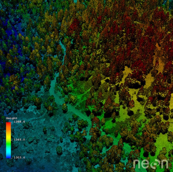
LIDAR is already being used for terrain mapping and surveying. It measures the distance to a target by illuminating the target with a beam of laser light and measuring the reflected light with a sensor. Differences in laser return times and wavelengths can then be used to make highly accurate digital 3-D representations of the target.
LIDAR can be used for the identification, growth, health and 3D simulation of the tree.
LiDAR data collected by the National Ecological Observatory Network Airborne Observation Platform (NEON AOP)
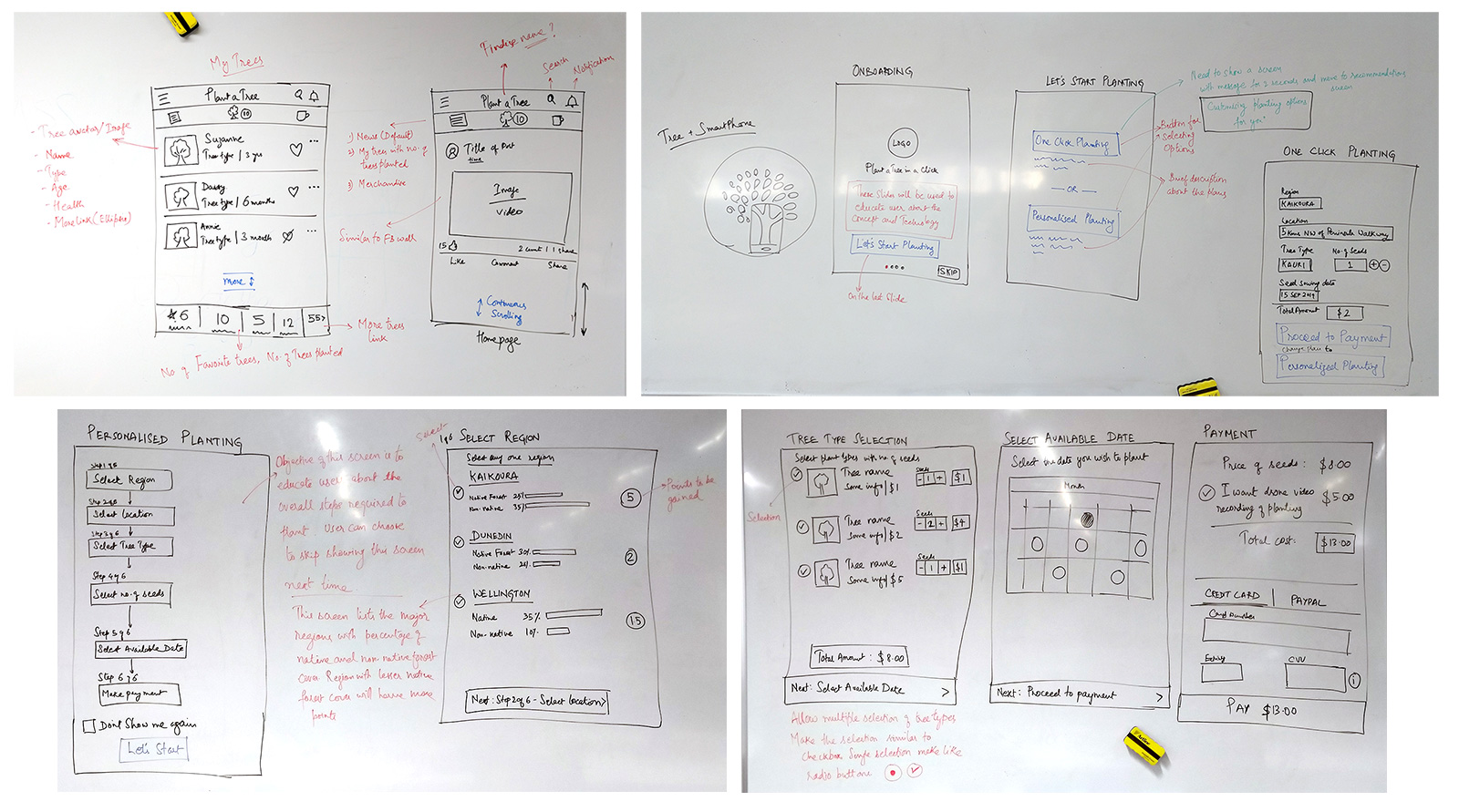
The Idea Dumping
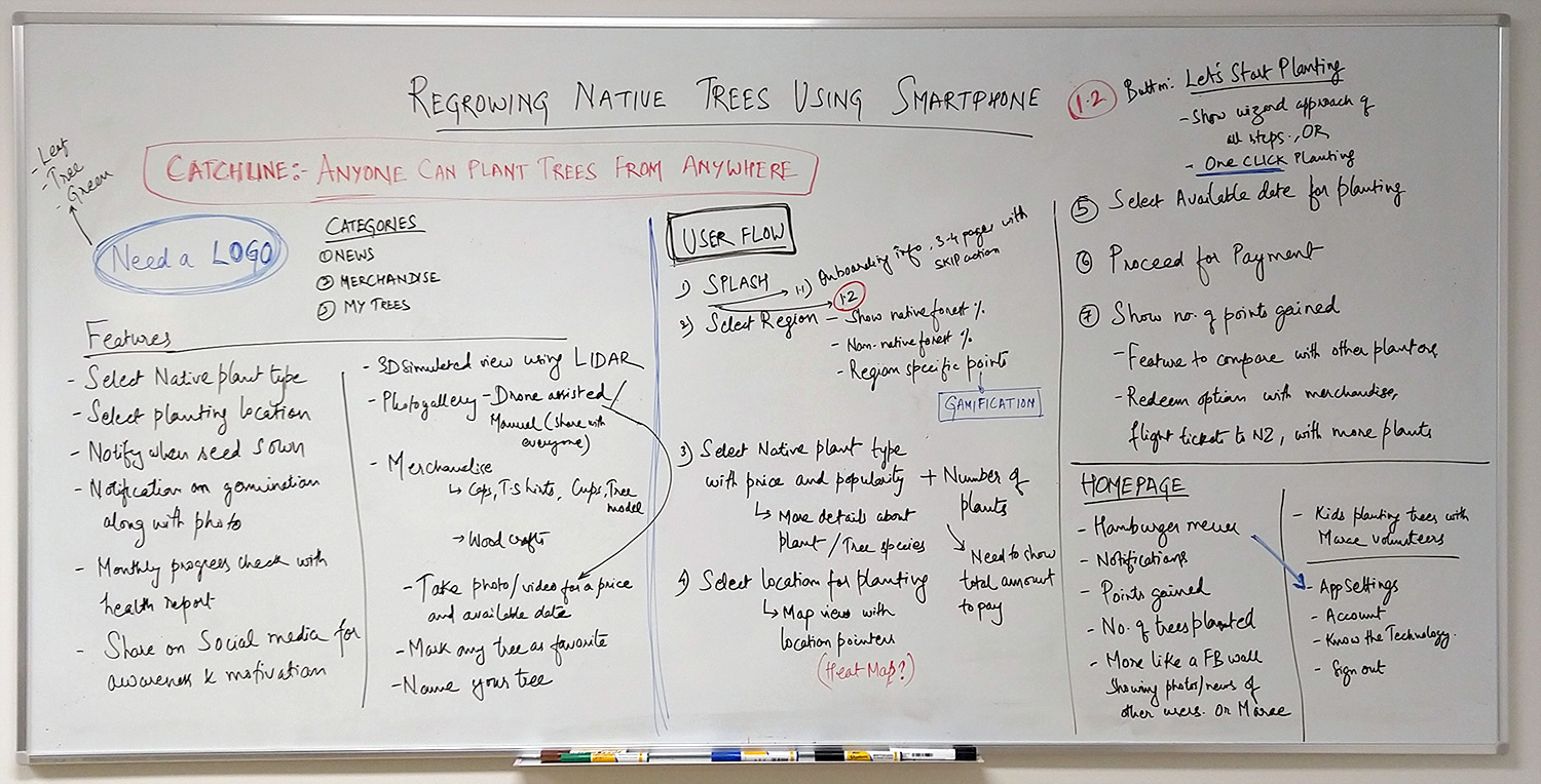
I had to start with a clean slate. There is currently no solution which I can use as a reference. The background research only helped me with what technology can do.I started by listing out every possible feature on a whiteboard, irrespective of how small or crazy the idea is.
I started with the most obvious or big features. That triggered the finer ones. I did a final review at the end to remove any feature which seemed technically too far-fetched or might not add value.
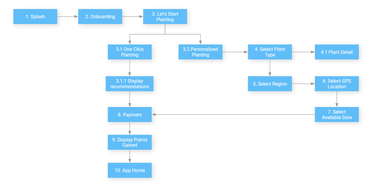
User Flow
I sketched out the cognitive walkthrough of the users’ mental model and the steps user might take to accomplish their goal. For each step, I mapped the possible features. That triggered how the user interface may look like.
Sketching Out the UI
I tested the sketches with 5 users and updated the design with a few reasonable feedback.
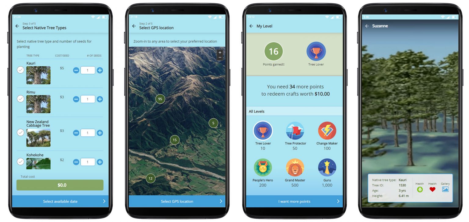
Building the Experience
Testing with users gave the insight that users would prefer using this app more for consumption rather than contribution. That prompted me to design the app for more user engagement with these features:
User Posts: This showcases social feeds by other users of the app with like, comment and sharing features.
My Trees: This section lists the trees planted by the user. Each list shows tree name, health, mark as favourite action, and access to 3D simulated view using LIDAR
Tree Shop: This is the online shopping section for users to buy Maori woodcrafts. A part of the revenue generated will be used for making this effort sustainable.
Bells & Whistles
The feel-good factor of a product or service comes from its bells & whistles features that add more value and glamour to it. Let’s have a look at a few of them:
One tap planting: This will be the main highlight of the mobile app which enables a user to plant a tree in just one tap. The app makes the recommendation based on the native forest cover of a region and figuring out where it is needed more.
Drone-assisted live view: Users can request for a live view of their tree for a nominal fee. Drones can be programmed to take photographs and also stream high-definition videos.
Social respect: This is a noble cause and will garner social respect. It will also encourage others to use this app and plant more trees.
Gain tree points: For every tree planted, users can gain points which can later be redeemed for Maori woodcrafts, flight ticket discounts to NZ or recognition from NZ government which in-turn will benefit tourism.
Monitor health: LIDAR data can measure tree height, girth, trunk volume, and foliage density to determine the overall health of the tree.
3D simulation: Using LIDAR data points, 3D simulated view of an individual tree inside the forest canopy can be computed. User controls can be added for a 360-degree view and zooming in or out features.
The Working
Once the user completes selecting the tree seeds, location, date to plant and makes the payment, a request is raised on the server. The local team receives a notification in their app dashboard about the type, quantity and location of seeds to be planted. The team loads the seeds in the drone and assigns the task to it. The drone takes off and navigates itself to the user-defined GPS coordinates. Using a seed gun, the drone shoots the nutrient covered seeds. Once the seeding is complete, the drone flies back to the launchpad. The user will be notified with photographs or videos of the planting.
The LIDAR tracks the terrain for any seed germination. It also captures data about tree growth, foliage density, girth measurements. These parameters give a good idea about the health of the tree.
End Note
This concept is just an attempt to think out of the box and fight climate change with an altogether different perspective. It explores how technology can bridge the gap between humans and nature and revive the age-old vital connection between both.
Interactive Prototype
Prev Project
Smart mobile solution for identifying real-time parking space
Next Project
Redesigning the search experience of Victoria University library website